What a great trip (and for us, a great read). How much did your pack weigh at the start? I'm curious because hauling a 50 lb. pack up and down steep terrain is hard enough (you know us old dudes have balance issues); I don't want to think about the problems I'd face coming down that river. I'm guessing hiker poles aren't all that helpful.
Also, do you always filter/purify your water in the back country?
-
Awesome trip, BP. How much weight did you lose? On the 55-miler I did in the Uintahs a few years back I think I lost 11 or 12 lbs over the 5 days, and it wasn't half as demanding as what you did.Leave a comment:
-
Day 6 – This is day that we were waiting for. No trails down these 10 or so miles of river. I think it is referred to as the “Bottom Nine” by kayakers. Scouring the internet, which is not always the best, but it is the only source really we had. I could only find 2 instances of people actually making it through by foot through this section. The last was in 1999 and both of these were going upstream. So it was with some trepidation that we headed out early, at least for us, at 8 in the morning. We knew it was going to be tough, so we decided that we were going to get wet today so no trying to avoid getting the feet wet and that we were going to see a lot of poison oak, so there would be no point in trying to avoid it. I did wear pants and a long sleeve shirt to try and minimize exposure, but as I have already mentioned it was not completely successful. Could be much, much worse.
We rounded bend after crossing the river and passed through Little Tehipite Valley. Looked back upstream for another great view of Tehipite Dome. This would be the last time we would see it for the day.
Will be years before I get back here, but I have committed to bring my wife here some day.
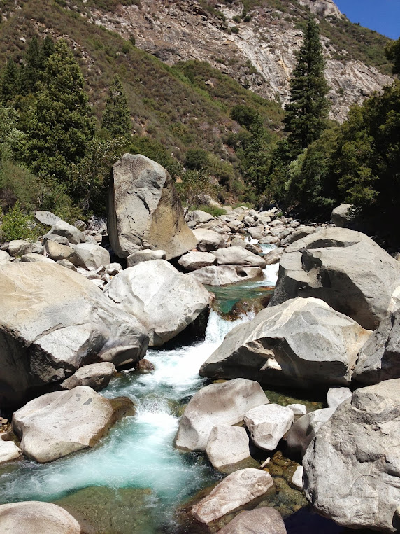
This was a long and grueling day. You wouldn't think it would be that bad, but 10 miles of wild river is tough. Thank heavens for this being a drought year. Would have not been possible if the water was higher. We had to cross the river probably 20 to 25 times. Maybe 10 or so times we came to a point where the river would cut into a wall and we had to make the decision of how to go up and over or through. We did not have dry bags, which in hindsight was a problem. It we had been prepared to get our bags all the way wet, we could have cut a lot of time and swam through some deep holes. As it was, we managed to stay out of water deeper than 4 ft. Waist deep was scary enough at times. This was fast moving water and often times we had to cross above a series of rapids.
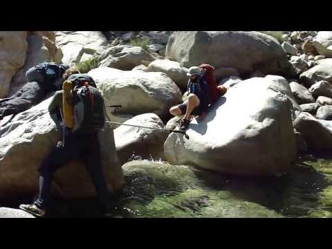
River Crossing:
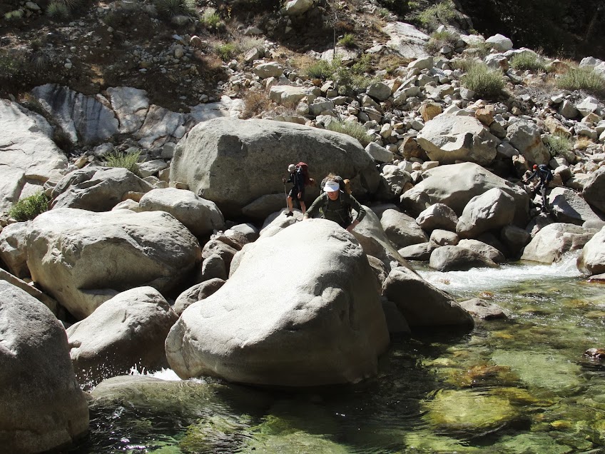
I have a video which I will try and post, of us crossing, which makes it look wimpy, but it was not, I guarantee you. If you went it, especially with a pack, it could be very bad.
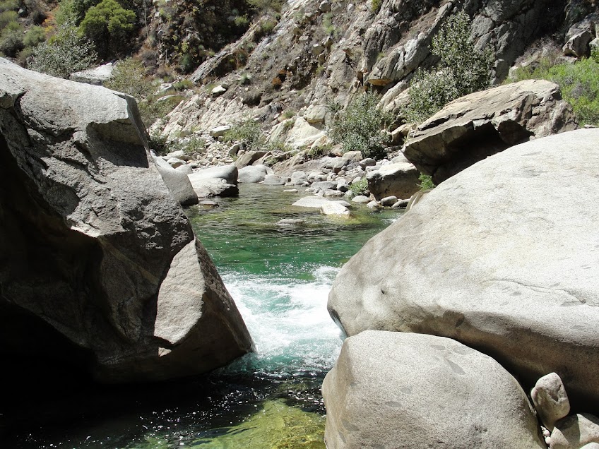
Place where we stopped briefly to swim, and where I lost my wedding ring
The bushwhacking was also bad. There was lots of holly and willow and of course poison oak. There were a couple of time on the side a very steep hill that I was not is a happy place as we followed a bear trail. One of the problems with crash through the bush like we did was that it knows off leaves and they get stuck between your pack and your head, and then some of them manage to work their way down the back of your shirt. This is where the worst of my poison oak is. If I could have avoided that, I would be ok today, but I didn't and it sucks.
The goal was to make it to the confluence of the South Fork and the Middle Fork before it got dark. As the day wore on I was afraid that we would not make it. Around 5 I could see a bend ahead that, based on the map, I determined was the confluence. Maybe it was later, but it seemed close, but it took forever. One of my friends totally bonked, which made it really hard when trying to cross the river or climb over class 3 routes. But we finally made it. I stepped in the crossing at the South Fork of the Kings, at 8:01 pm. Twilight was settling in, but it was enough to see to cross the river for the last time of the day.
We filled up water reservoirs by headlamp for the 2 mile 1000 ft climb up the trail to the road. We hike up from 8:30 to 9:30, and I bonked on the way. Lots of water and almonds later, we made it.
Epic. I know we were not the first to do this, but DAMN!!! We are the first I have been able to find that have done it going downriver, besides guys in kayaks that is.
After a few frustrating failed hitchhiking attempts to get the 22 miles up the road to where our car was up at the end of the road, one of our party got a ride and was back to us by 11 at night. We loaded up the car and headed to Visalia. Then it was Dennys at 2 in the morning for hamburgers, some strong steroids from Rite Aid (again, bring a doctor –the idea was to prevent the poison oak from happening by taking some strong stuff, but all it did was delay its onset; it was a nice try) at 3 and then finally shower and bed at 3:30 at the econolodge.Leave a comment:
Leave a comment: